Geodetic Control and Topography: The Chain Behind Every Survey
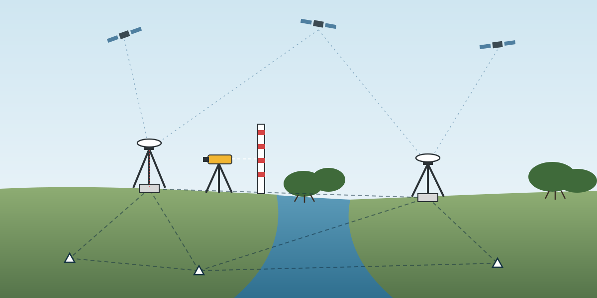
Every survey in an oil and gas field leans on a few points on the ground. The rig move, the pipeline route, the bathymetry and the platform monitoring all end up as coordinates and heights. Those numbers are only as good as the control they were tied to. Geodetic control is the least visible part of a survey package, and the part that everything else depends on.
This is the second article in a series based on a project execution plan I prepared for a topography and positioning services package. The first article covered the plan as a whole. This one looks at one family of services in it: geodetic control and topography. Client, project, field and location details are left out.
The service lines in this family
The plan listed six land and control services, plus two that sit close to them:
- GNSS static observation, for reference points and precise points.
- Precise levelling.
- Reconnaissance survey.
- RTK DGNSS survey.
- Traversing survey.
- WADGNSS survey.
- Positioning and monitoring for platform, pile and pin connector installation.
- Platform settlement and deformation monitoring, as an analysis service.
On paper these are separate items with their own equipment tables. In the field they form one chain. Reconnaissance finds the ground, static GNSS fixes the main points, levelling gives them reliable heights, and RTK, traversing and WADGNSS carry that control out to where the work is.
Reconnaissance comes first
A reconnaissance survey is easy to cut from a budget and expensive to skip. In a delta with swamp, river channels and tidal flats, the map rarely shows what the ground is really like. The recon team checks:
- Whether existing bench marks and control points are still there, still stable and still the ones in the records.
- Where new monuments can be built on firm ground, with access by boat or on foot.
- Where the sky is open enough for GNSS, and where trees or structures will force a traverse instead.
- Lines of sight for total station and levelling runs.
- Practical things: tide windows for boat access, landing points and safe working areas.
The equipment list for recon in the plan was the same as for levelling and traversing: a total station or precise level, staffs and tapes. Recon is not only looking. It is also a first check of whether old control still agrees with itself.
Static GNSS: the backbone
The main reference points are fixed by static GNSS sessions with multi-frequency geodetic receivers. The plan called for two receivers as the main units, so that each new point is observed at the same time as a known point and processed as a baseline.
Static GNSS is slow on purpose. Long sessions average out multipath and atmospheric effects and let the processing resolve ambiguities properly. The output is a small network of points with known coordinates and ellipsoidal heights, tied to the project datum and adjusted as a network so that errors show up instead of hiding.
The plan's equipment table for this service included the materials to build monuments: cement, sand, steel rods, nails and survey tape, together with first and second order bench mark markers. That says something about the work. In a swamp or delta there is often no usable control, and the team builds its own. A monument that sinks or gets knocked over in the first month is worse than no monument, because it gives wrong answers with confidence. Firm ground, good concrete and clear marking matter as much as the GNSS processing.
Precise levelling: heights you can trust
GNSS gives ellipsoidal heights. Most engineering work needs heights above a vertical datum: mean sea level, chart datum or a project datum tied to the local tide. The link between the two is a geoid model plus local checks, and precise levelling is how those checks are made.
The plan listed a precise level or a precise total station, levelling staffs with a bubble, tapes, and temperature and pressure sensors. The sensors matter for long sight lines and for the total station's distance measurements, which are corrected for atmospheric conditions.
Precise levelling is done in closed loops or double runs between bench marks, so that every line has a check. The misclosure is compared with an allowable value that grows with the length of the run. A loop that does not close is run again, not adjusted away.
In a coastal field, levelling also ties the land control to the tide gauges. That link is what lets bathymetry measured from a boat be reduced to the same datum as the topography on land. Without it, the land and sea surveys can each be correct and still not match at the shoreline.
RTK, traverse and WADGNSS: carrying control to the work
Once the backbone exists, three methods carry it to the places that need detail.
RTK DGNSS uses a base on a known control point and a rover that gets corrections over radio. It is fast and gives centimetre-level positions in open areas, which suits detail and topographic surveys, stakeout, and checking temporary points. Its weakness is that it can produce a confident but wrong fix if the base coordinates are wrong or the rover is close to tall structures or trees. Every RTK session should start and end on a known point.
Traversing with a total station is the answer where GNSS struggles: under mangrove canopy, next to steel structures, or inside plant areas. A traverse runs from known control, measures angles and distances around a series of stations, and closes back on known control so that the misclosure can be checked and distributed. It is slower than RTK, but it works where the sky is blocked.
WADGNSS, wide area differential GNSS from a satellite correction service, covers the offshore end. It gives decimetre-level positions without a local base station, which is what vessels, barges and rigs use. It is not a replacement for land control, but it has to agree with it. That is why the DGNSS verification against known points on the wharf, described in the first article, is so important.
Installation monitoring on a platform
The positioning and monitoring service for platform, pile and pin connector installation sits between the land and offshore worlds. The plan's spread was a total station with tripods and prisms, two precise levels, a GNSS compass for heading, and marker buoys. The crew was two topographic surveyors and two assistants.
On a platform, the job is to measure where steel actually ends up compared with where the design says it should be: pile positions and inclination, connector alignment, deck levels. Two levels allow independent checks, or two teams working in parallel. Measurements are taken from control points set up on the structure itself, which are tied back to the field control at the start.
Settlement and deformation monitoring
Platform settlement and deformation monitoring was listed as an analysis service. The crew was geodetic engineers and data analysts rather than field surveyors, with processing workstations as the main equipment.
The principle is simple. Repeat the same measurements on the same points over time, and look at what has changed. The difficulty is in separating real movement from measurement noise. That needs:
- Stable reference points away from the structure, checked every time.
- The same method, instruments and setup at every epoch, as far as possible.
- A proper adjustment with error estimates, so that a change of a few millimetres can be called significant or not.
- A history of results that shows trends, not just a single difference.
This is where good control from the beginning pays off. If the reference points were poorly built or poorly measured, there is nothing to measure against.
Temporary markers
The plan also had a small service for setting temporary markers: wooden stakes on land and plastic buoys or jerrycans offshore. It looks trivial next to the other items, but temporary markers are how survey results are shown to the people doing the work, such as a dredger, a pile crew or a rig move team. A marker in the wrong place is a survey error that people can see.
What I took from it
- Treat the control services as one chain. Recon, static GNSS, levelling and RTK or traverse each depend on the one before.
- Build monuments as if they must last. In soft ground, a monument that moves is worse than none.
- Get the vertical datum right at the shoreline. Land and sea surveys only meet if levelling ties them to the same datum.
- Close everything. Levelling loops, traverses and RTK sessions should all end on known points.
- Monitoring is only as good as its reference. Settlement results are meaningless without stable reference points measured the same way each time.