Rig Move Positioning: Getting a Drilling Rig onto Location
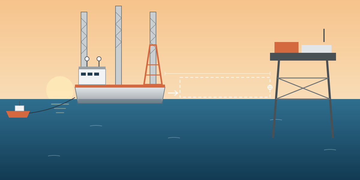
Moving a drilling rig from one location to another looks simple on a chart: two points and a line between them. In practice the last few hundred metres, when the rig comes in next to an existing jacket, are some of the tightest positioning work offshore. The rig has to end up at an exact position and heading, close to a structure it must not touch.
This article is based on a method statement for rig positioning and navigation services, written for a rig move between two jacket locations in an offshore field. I was involved as project surveyor and surveyor. It covers how the survey side of a rig move is set up and why. Client, rig, field and location details are left out.
What the survey team is there for
The scope in the method statement was short and clear:
- Install and test a navigation spread on the rig.
- Calibrate and verify the positioning systems.
- Give the rig crew a real-time display of position and heading, together with the field layout.
- Monitor the rig closely during the approach to the jacket and while it is stationary next to it.
- Take the final positioning fix at the target location.
- Advise the project team on survey matters, keep a detailed log and issue field memos for important events.
The crew was a party chief, a senior surveyor and a senior engineer, so positioning was covered 24 hours a day for the whole move.
The target is a point and a heading
The client gave the target location as the centre of the rig's stern (transom), with coordinates and a required heading. That choice says a lot about the job. For a rig working next to a jacket, the stern is typically the side that faces the structure and where the drilling equipment reaches over it, so that is the point that has to be right. The heading matters just as much: a few degrees of rotation moves the far end of the rig sideways by metres.
So the survey setup has to compute, in real time, the position of a point on the rig that has no antenna on it, using the antenna positions, the heading and measured offsets. If the offsets or heading are wrong, the stern position on the screen is wrong, even when the GPS is perfect.
What the client must supply
Before mobilisation, the survey team needs:
- Rig details and drawings, so the outline and reference points can be built in the navigation software.
- The site layout in CAD, in the correct coordinate system, showing the jacket, pipelines and other assets.
- The project procedures and schedule.
- Geodetic parameters, and a control point for checking GNSS and gyro.
The target coordinates and heading go into the navigation system before the move starts, and are checked by a second person.
The spread
The navigation spread was simple and redundant:
- Two independent DGNSS receivers with C-Nav correction, each with its own antenna.
- A Meridian Surveyor gyrocompass for heading.
- EIVA NaviPac on a marine computer for online navigation and logging, with an external helmsman display on the rig's control position.
- A second NaviPac computer for data logging.
- An online printer, cabling and two UPS units.
- A Leica total station, prisms and tapes for offset measurement and checks.
Two independent position systems are the minimum. With only one, there is no way to know that it is wrong.
Mobilisation checks
The method statement was firm on one point: the rig does not start the move until every system has been installed, tested and calibrated. The checks were:
- Interfacing of the whole navigation spread, and a test of the online computer.
- Logging test of every sensor and interface.
- Offset measurement of every point of interest relative to the common reference point.
- Gyro alignment by sun shot observations.
- Comparison of the two independent GNSS systems.
Offsets. The common reference point is the primary DGNSS antenna, ideally above the bridge on the rig centre line. Every other point, including the second antenna and the stern centre reference, is measured from it using land survey methods with a total station, and then checked with tapes. The reduced values are entered in NaviPac and handed to the data processors.
Gyro by sun shot. A rig at sea has no quay and no shore control to check heading against. Sun azimuth observations solve that: the true bearing of the sun is computed for the exact time of each observation and compared with the rig's centre line, giving the gyro error. It is one of the oldest survey techniques still in daily use offshore, and for good reason.
Geodesy. The project used WGS84 / ITRF2008 on a UTM grid, with no datum shift. A test coordinate was transformed in NaviPac at mobilisation and the result compared with known values, so that any setup error is caught before the move.
When everything is installed, the surveyor completes the project checklist, which goes back to the survey manager with the system configuration and geodetic test printouts, and is signed by the client representative.
Online navigation
NaviPac had to meet a few minimum criteria:
- Sample and compute all positioning data, with a cycle time no longer than two seconds.
- Process and display sensor data in real time.
- Flag non-conforming data, with printouts for the record.
- Log all raw data from every sensor.
The helmsman display shows the rig outline, its live position and heading, the target outline at the final location, and the jacket and other assets. On the approach, the people moving the rig need to see two things clearly: how far the stern is from the target, and how far the rig is from the jacket.
The approach and final fix
The method statement singled out two phases:
- The approach to the jacket, where the display must show the jacket edges clearly and the rig's movement is watched continuously.
- The time when the rig is stationary next to the jacket, where any unexpected movement has to be noticed at once.
At the end, a final positioning fix is taken at the intended location: stern centre coordinates and heading, compared with the target. That fix is the main deliverable of the job, and the reason the whole spread exists.
Real-time QC
The online surveyor watches, on time series plots:
- GNSS correction status and position quality.
- Gyro heading.
- The secondary positioning system.
- Sensor update rates.
- The difference between primary and secondary positions.
If the two GNSS systems start to disagree during the approach, the surveyor tells the rig move team straight away, before the rig gets any closer to the jacket.
Records and reporting
- Rig move records throughout, and the final fix as required by the project.
- Daily survey logs covering equipment, software, geodetic changes and weather.
- Daily progress reports covering the last 24 hours, the plan for the next 24 hours, downtime and HSE.
- A draft final report within 14 days of demobilisation, and the final report within 14 working days of client comments.
Data was backed up every day.
What I took from it
- Define the target the way the rig uses it. A stern centre point and a heading is more useful than a single "rig position".
- Offsets are as important as GPS. The point that matters has no antenna on it, so it is only as good as the offsets and heading behind it.
- Sun shots still matter. Offshore, with no shore control nearby, they are the independent check on heading.
- Two systems or none. A single positioning system can be wrong with no warning. Two systems that agree give confidence, and two that disagree give time to react.
- A short method statement is fine if it is clear. This one was only a few pages of real content, but it said what had to be checked, who signs off, and when the rig is allowed to move.